Going for a run? Share your progress with Google Maps
I’ve done a number of long runs in the past few years, both at Ultramarathon events and in training beforehand. In online forums for these events people often discuss whether they should hire GPS trackers but I’ve been using the free Location Sharing feature on Google Maps instead as I’m already carrying my phone.
Why Share?
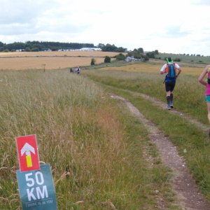
In the training runs in particular tracking is also a good safety feature. If I’m not back home when expected then my family can quickly check to see if I’ve stopped (possibly injured) somewhere or if I’m just taking a scenic detour past the beer garden of the Coach and Horses.
Does the battery last?
I’ve found that on my Android phones (currently a Moto G6) I’ve not had any really noticeable impact on battery life when using Location Sharing. If I’m on one of my longer runs (over 6/7 hours) then I’ve usually got a portable USB battery stashed in my running bag with the first aid kit and Jelly Tots anyway. I find that using the camera and screen is more likely to impact the battery life.
How to set it up
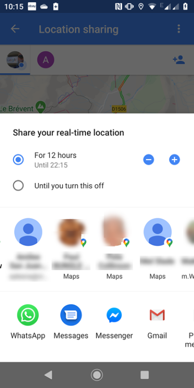
This is how I set up Google Maps Location Sharing on my phone. Your experience may differ, but hopefully not by much.
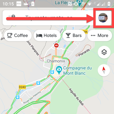
- Open Google Maps on your phone and tap on your picture on the top right hand corner
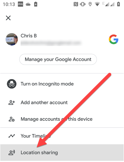
- On the menu, choose “Location sharing”
- The next screen will show anyone you are already sharing with, Tap the “Add people” button in the top right.
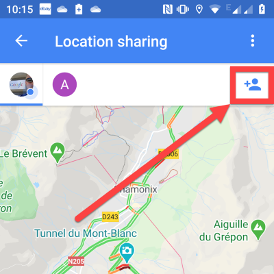
- You can then set how long you want to share your location for- here it often makes sense to say “Until you turn it off”- if you forget to then Google will email you a reminder periodically over the coming days. Finally either pick contacts to share your location with or choose to share a weblink by email/ WhatsApp etc.
And that’s it. Lace your trainers up and off you go. Just remember to take your phone with you!
Footnote- it’s worth remembering that as with the GPS trackers your position will only be updated when you have data reception The Maps app will however show how long ago the last reading was taken so if you are disappearing off into the wild where there’s no cell coverage your friends might see a “20 minutes ago” note below your icon.